Historical Maps of Balbriggan

In 1875, the sale of the estate of George Alexander Hamilton took place at the Landed Estates Court on Inns Quay, Dublin. George Alexander was the 4th generation of the Hamilton family to reside in Balbriggan. His great grandfather Alexander settled in the area in the early 18th century. From that time, the family invested considerable funds in developing the town’s infrastructure and soon established thriving textile and maritime industries.

The estate was divided into 22 lots and included the entire town of Balbriggan itself. The sale is of particular historic significance due to the transfer of ownership of the town from the Hamilton family to a new entrepreneurial class. This exhibition by Brian Kavanagh looks at the auction that became known as ‘The Sale of Balbriggan’ and includes maps of the various lots from the estate catalogue. Fingal Local Studies & Archives wishes to acknowledge the assistance of the Balbriggan and District Historical Society in creating this exhibition.

The exhibition was on view at Bremore Castle during Heritage Week 2025.

Exhibition PDF – The Sale of Balbriggan 1875 (English)

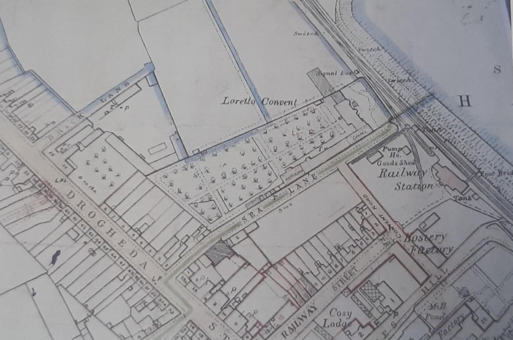
Balbriggan, 1865

Ord. Sur. Ire., coloured manuscript map of Balbriggan, 1865

A Drogheda Street and Sea Lane view showing the Brick Lane, which led to the brick fields. These fields were worked by the Cumisky family.
They had advertised in March 1866 for a ‘steady, active man’ to manage the ‘burnt tiles’ facility owned by C. and T. Cumisky.¹⁸⁰
A hosiery factory was shown, as was the Loretto convent (Gracefield House).

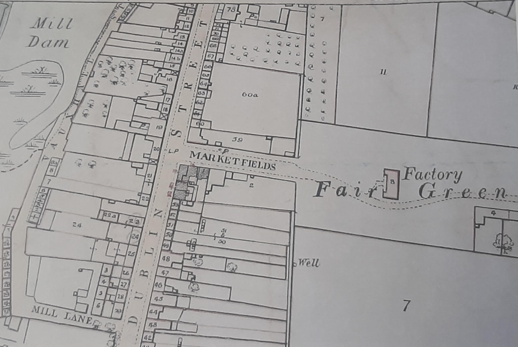
Southern Balbriggan, 1865

Ord. Sur. Ire., coloured manuscript map of Balbriggan, 1865

This southern view of Balbriggan shows the Marketfields, Fair Green, and the market house as a factory, but no mention of what was made there is given on the map.
The former Fox’s Hall had become Vauxhall Street.
A well is seen at the rear of a dwelling on Dublin Street.

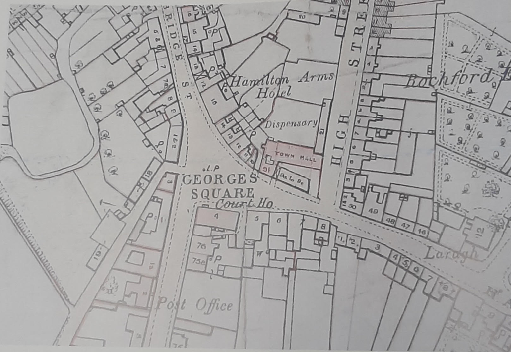
Civic Center (George’s Square)

Ord. Sur. Ire., coloured manuscript map of Balbriggan, 1865

The population in 1861 was 2,258 and within its administrative boundary were 180 acres.¹⁷⁹
In this central view of the town is seen the Hamilton Arms Hotel (owned by Mary Seaver). A post office was on Dublin Street. Two large residences, Laragh and Rochford House, were on George’s Street.
There was a dispensary in High Street adjacent to a Town Hall marked in the colour red. A courthouse, built c. 1849, was in situ as well.
The shambles (slaughterhouse), which was across the road from the courthouse as seen in the 1843 manuscript map, is no longer to be seen.
Laragh is long gone but Rochford House has survived in the guise of the ‘Sunshine House’.

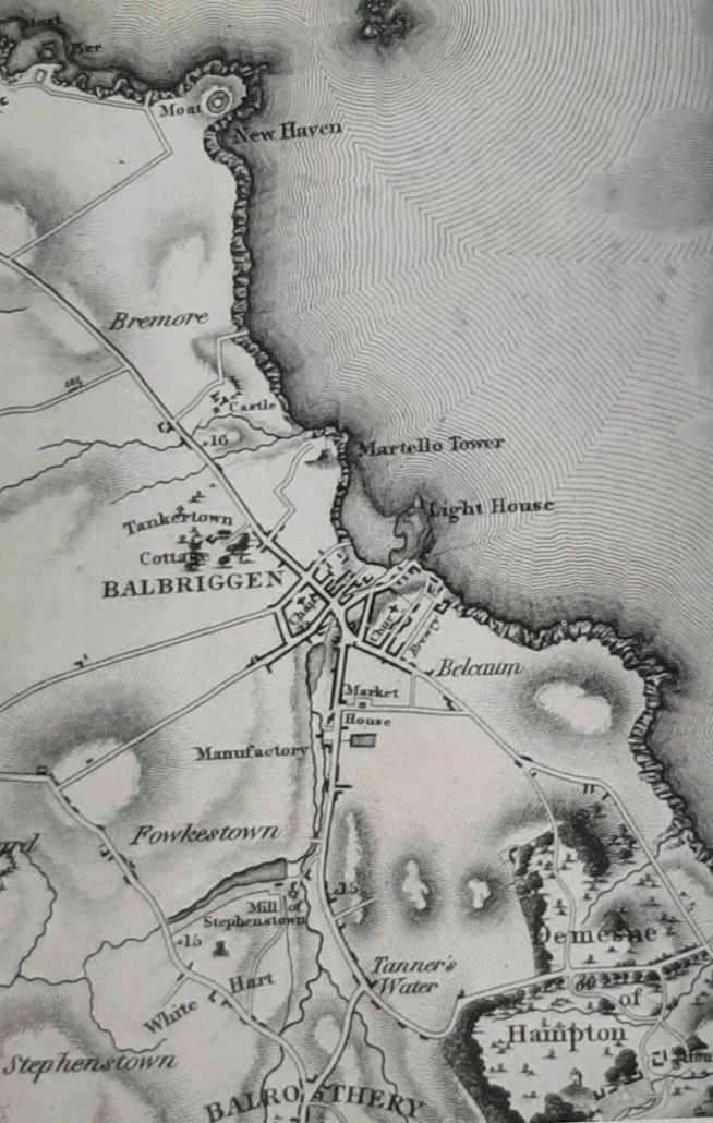
Map of County Dublin by William Duncan 1821